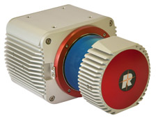
Riegl miniVUX-2UAV

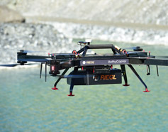
The RIEGL miniVUX-2UAV is an extremely lightweight airborne laser scanner, designed specifically for integration with UAS/UAV/RPAS. The sister type of the proven RIEGL miniVUX-1UAV sensor offers 100 kHz and 200 kHz laser PRR. With 200 kHz PRR, the sensor provides up to 200,000 measurements per second and thus a dense point pattern on the ground for UAV-based applications that require the acquisition of small objects.
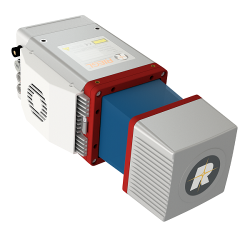
The small and sophisticated design of the stable aluminum housing offers various integration possiblities with platforms that offer restricted space or payload capabilities. The 360° field of view allows complete acquisition of the environment.
An easy-to-remove SD card for data storage, and/or the option for streaming the scan data via LAN-TCP/IP interface, in combination with the modest power consumption of the scanner, enable straight-forward integration with most UAS/UAV/RPAS types.
The RIEGL miniVUX-2UAV makes use of RIEGL’s unique Waveform-LiDAR technology, allowing echo digitization and online waveform processing. Multi-target resolution is the basis for penetrating even dense foliage. As a further special feature, the wavelength is optimized for the measurement of snowy and icy terrain.
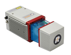
In addition to the stand-alone version of the miniVUX-2UAV, RIEGL also offers fully-integrated solutions.
Main features:
- 100 kHz / 200 kHz Laser PRR selectable
- measurement rate up to 200,000 measurements/sec
- scan speed up to 100 scans/sec
- very compact & lightweight (1.55 kg / 3.4 lbs)
- 360° field-of-view
- robust aluminum housing, ready to be mounted on multi-rotor, rotary-wing, and fixed-wing UAVs
- make use of RIEGL's unique echo signal digitization and online waveform processing
- multiple target capability - up to 5 target echoes per laser shot
- mechanical and electrical interface for IMU mounting
- exceptionally well suited to measure snowy and icy terrains
- user-friendly, application- and installation-oriented solutions for integration
Main applications:
- Agriculture & Forestry
- Glacier and Snowfield Mapping
- Archeology and Cultural Heritage Documentation
- Construction-Site Monitoring
- Landslide Monitoring
Hardware
Software
Andre relevante produkter: